
EDITOR’S NOTE: This regional flora is currently under construction as I am finishing up my end of year photo editing. Please check back again to see an updated version
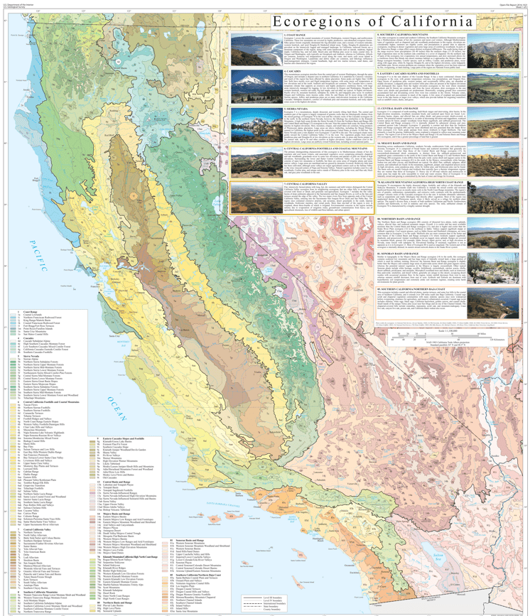
California’s geology is rather recent, at least in the broad timespans orogeny; California is the result of several major tectonic events that forever altered it and the neighboring states.
Simply put, the Farallon Plate subducted underneath the N American resulting in the volcanic ranges of the Sierra Nevada. Buoyant terranes accreted on the Western Valley of the forming Sierras and became the Coast Ranges. The Cascades formed similarly when the Juan de Fuca plate subducted under the N. American plate.
The geology of such a complex state is equally complex. Much of the Sierra Nevada is composed of granite, but thanks to the subducting Farallon Plate, Serpentine and other metamorphics are just as common. Sedimentary materials are more common in the central valley towards the coast.
Rainfall obviously differs depending on year and location within the state, but the historic average is around 22 inches. The Southernmost and Easternmost portions of the state tend to be the driest, whereas the Central Valley and Northern California are the wettest.
Sierra Nevada
World renowned for having some of the most beautiful scenery and untouched wildlands, the Sierra Nevada Mountain Range dominates the Eastern portion of California. Many of the species that live in these mountains cannot be found anywhere else. The range extends about 400 miles North-South from Fredonyer Pass to Tehachapi pass. Elevations vary across the range but generally increase in elevation from North to South; the lowest point is Beckwourth Pass at 5,221 ft., and the highest point (also in the contiguous U.S.) is Mt. Whitney at 14,505 ft. Most of the rocks found in the Sierra Nevada Mountains are volcanic or metamorphic, with a large chunk of that being the granitic batholith that formed with the subduction of the Farallon Plate.
Lake Tahoe
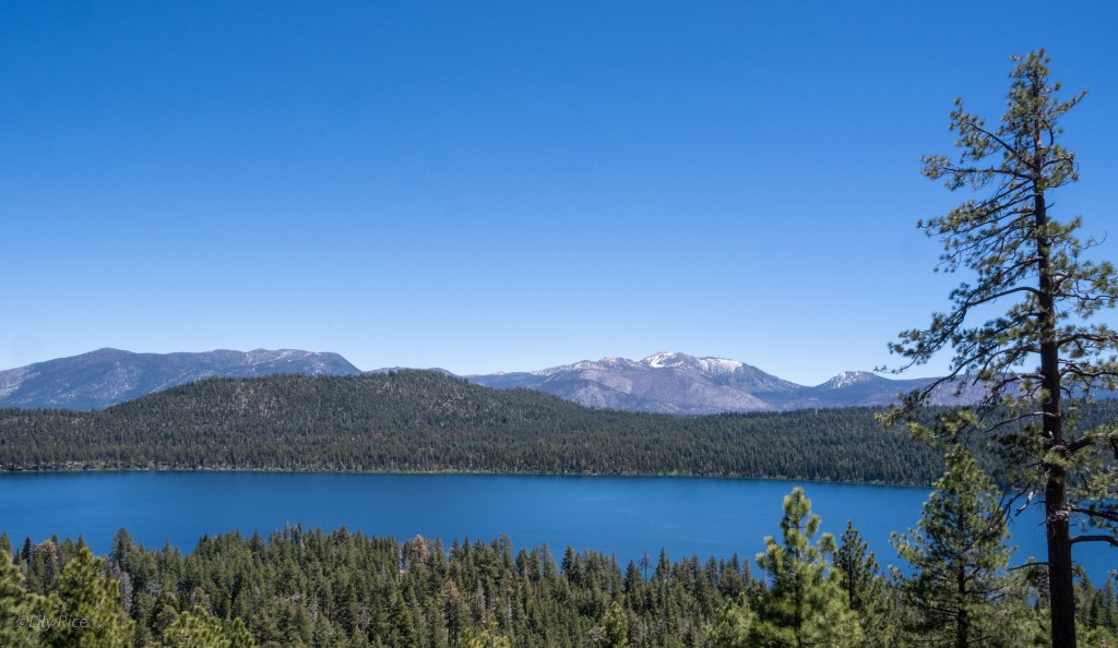
Lake Tahoe is the largest alpine lake in North America. It sits at 6,225 ft. and has a maximum depth of 1,645 ft., about at the elevation of nearby Reno, NV. The mountains surrounding Lake Tahoe vary in elevation but are all around 10,000′. The outflow of Lake Tahoe is the Truckee River which flows down into Nevada and deposits into the endorheic basin, Pyramid Lake. The homeland of the Wašiw (Washoe) people, DaɁaw (The Lake) has been revered for thousands of years. Tragically, like many of the other Tribes of the U.S. much of their homeland has been forcefully removed by the United States. There are still several populations still living in the surrounding areas and were recently given some stewardship input as a part of the collaborative Lake Tahoe Destination Stewardship Plan. There are several species and varieties native to the region such as Rorippa subumbellata (not pictured here). The plant communities around Lake Tahoe are mostly conifer woodlands or wetlands.

Red Lake Peak
Red Lake Peak has an elevation of 10,068 ft. and is named after the nearby Red Lake. The Peak is within the Carson Ranger District in the Humboldt-Toiyabe National Forest. It is believed that this peak is where the Europeans John C. Fremont and Charles Preuss sighted Lake Tahoe for the first time, which the Wašiw people had enjoyed for thousands of years prior.

Mt. Patterson
Mt. Patterson is a part of the Sweetwater Range which extends into Nevada. This mountain is a part of the Bridgeport Ranger District of the Humboldt-Toiyabe National Forest. Its peak sits at 11,654 feet.

Mt. Dunderberg
Mt. Dunderberg is the southernmost point in the Bridgeport Ranger District of the Humboldt-Toiyabe National Forest. It is adjacent to Hoover Wilderness, Yosemite National Park, and Inyo National Forest. The peak of Mt. Dunderberg is at 12,379 ft.

White Mountains
Technically separate from the Sierra Nevada Range on the opposite side of Owens Valley, the White Mountains is a 60 mile long by 10 mile wide range north of the Inyo Mountain Range. Much of the range is composed of dolomite, granite and other metavolcanics. The highest point within the range is 14,252 ft at White Mountain Peak. Found in some higher elevation secluded groves are large stands of bristlecone pine trees. Methuzelah, the oldest known non-clonal organism, is found within this range.

Mojave Desert
Death Valley
The hottest, driest, and lowest region of the United States, Death Valley is a unique habitat found just west over the border of Nevada. The lowest point within Death Valley is Badwater Basin at 282 ft below sea level. There are several ranges that surround Death Valley, the highest point found in them is Telescope Peak in the Panamint Range at 11,049 feet. The highest point within the continental United States, Mt. Whitney, is only 84.6 miles away. There are many endemic species native to this region such as Mimulus rupicola (not pictured here) that bloom when the fall and winter rainfall is both sufficient and consistent.

Alabama Hills
Known perhaps more so for the many spaghetti westerns that were filmed here, the Alabama Hills is a series of hills and weathered rocks 9000 ft. below the highest point in the continental United States, Mt Whitney at 14,505 ft. The rocks are almost entirely monzogranite and metavolcanic rocks. Growing out of the sparse decomposed granite can be found Astragalus coccineus, a stunning pea member found from the Owens Valley, Death Valley, and the mountains surrounding Los Angeles.

Mojave National Preserve


